MAPA: A Linked Open Data Gazetteer of Ancient Babylonia
Item
-
Title
-
MAPA: A Linked Open Data Gazetteer of Ancient Babylonia
-
Description
-
A poster presented at the DHSI 2021 – Online Edition Conference & Colloquium, June 7–14, 2021
-
Creator
-
Samuel D. Clark
-
Shai Gordin
-
Date
-
2021
-
Format
-
PDF
-
Rights Holder
-
Samuel D. Clark and Shai Gordin
-
Abstract
-
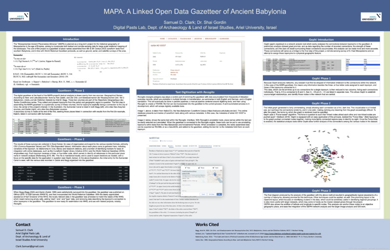
The “Mesopotamian Ancient Placenames Almanac” (MAPA) is planned as a long-term project for the historical geography of Mesopotamia in the age of Empires, aiming to incorporate both textual and remote-sensing data for large scale relational mapping of the landscape. The core of the project is a gazetteer of place names assembled from 6th & 5th Century BCE cuneiform texts from southern Babylonia, and in line with World Historical Gazetteer protocols, as well as ground, aerial, and satellite surveys of the area.
After a brief summary of the assembly of the recently published Gazetteer (v0.1: https://doi.org/10.5281/zenodo.4540616), the poster presents two next steps in the project, with a focus on the digital tools in use, and their unique benefits to the analysis. Specifically, the annotation tool Recogito (<https://recogito.pelagios.org/>) and the network analytics tool Gephi (<https://gephi.org/>).
Recogito, along with the in-browser Markdown editor StackEdit (stacked.io), is a central part of enriching the gazetteer with data accumulated from thousands of Akkadian everyday records, which are available in multiple formats: in transliteration, as summaries in both English and German, and in English translation. This is done in parallel pipelines: a manual pipeline centered around digitizing texts in Stackedit, and then using Recogito to create a TEI/XML file that can be incorporated into the gazetteer, and a semi-automated pipeline, which scrapes the necessary data from previously digitized or partially-digitized records using unique aspects of the Akkadian language and NER (Named Entity Recognition).
Gephi, a network analytic tool, easily analyses the connections between toponyms in the gazetteer. A preliminary analysis showed great promise, and as data regarding the number of recorded connections, the strength of these connections, and the (lack of) doubt surrounding these connections accumulates, this analysis can be made more and more accurate. These connections will serve as a bridge to the final step of the project, a remote-sensing survey of S. East Mesopotamia and an attempt to assign these toponyms to a physical geographic feature.
-
Type
-
Poster


